
Here’s a trail map for the current Big Hill Nordic Winter trail system:
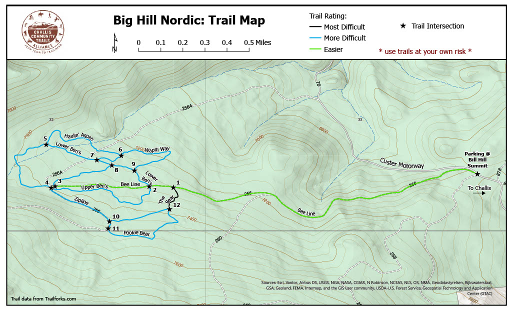
From the trailhead to the “4 Way” junction is about 1.2 miles, and from the trailhead to Roybal’s Roost is about 1.5 miles. If you ski all of the trails shown on the map you will have skied about 6-7 miles by the time you return to the trailhead.
Find the trailhead by heading out of Challis on the Garden Creek Rd., then continuing straight on the Custer Motorway when the Garden Creek Rd. turns to dirt and bends to the left. Parking is right after the cattle guard at the height of land, about 1.5 miles from the bottom of the Custer Motorway. If you start heading downhill you’ve gone too far!
Check the grooming report before heading out. If trails are groomed you will see a groomed road that runs parallel to the Custer Motorway leaving the parking area — follow that to the trails! There should be green signs directing you.
